
Updated:
06-Oct-2025 9:50am


Overnight
Mostly Clear
Lo 61 °F
Monday
Sunny then Chance Showers And T-Storms
Hi 76 °F
Monday
Night
Showers And T-Storms
Lo 54 °F
Tuesday
Rain Showers
Hi 61 °F
Tuesday
Night
Mostly Clear
Lo 44 °F
Wednesday
Sunny
Hi 58 °F
Sand Point Weather - Station DataUpdated: 06-Oct-2025 9:50am |
|
|
|
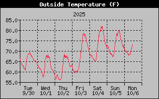
70.9°F Comfortable Feels like : 71°F |
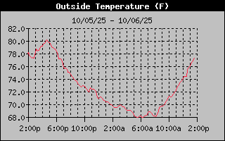
High Temerature: 71.2°F @ 12:11amm
Low Temperature: 67.9°F @ 5:37amm
High Yesterday Temp.: 80.3°F @ 4:50pm
Low Yesterday Temp.: 67.1°F @ 8:20am
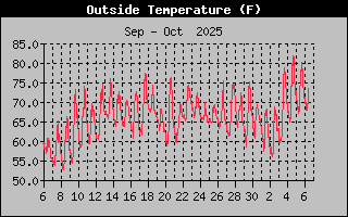
High Monthly Temp.: 81.8°F
Low Monthly Temp.: 55.9°F
High Yearly Temp.: 90.0°F
Low Yearly Temp.: -6.8°F
For this day (Oct. 06) the...
Average (Norm) High*: 65°F
Average (Norm) Low*: 43°F
Record High*: 89°F in 1963
Record Low*: 26°F in 2003
* Average & Record High/Lows are based on data from the Flint Bishop Airport, Flint, MI.


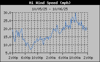
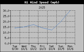
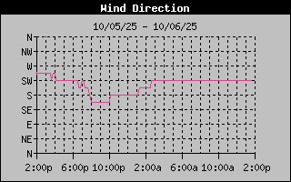
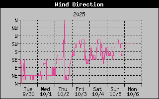
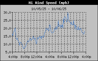
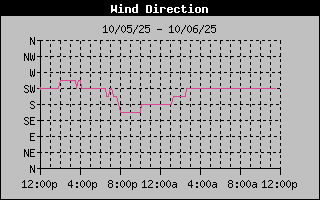
18 from the SW
Gust to: 24 mph
High Wind Speed: 27 mph @ 8:59am
High Monthly Wind Speed: 27.0 mph
High Yearly Wind Speed: 87.0 mph
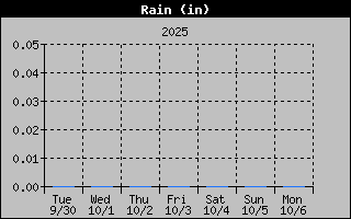
| Rain Today: | 0 in |
| Rain Yesterday: | 0 in |
| Storm Rain: | 0 in |
| Monthly Rain: | 0 in |
| Yearly Rain: | 12.72 in |


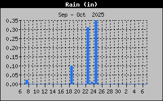
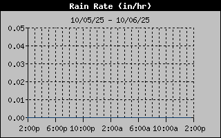
| Current Rain Rate: | 0 in/hr |
| High Rain Rate: | 0 in/hr @ ---- |
| High Hourly Rain Rate: | 0 in/hr |
| High Monthly Rain Rate: | 0.00 in/hr |
| High Yearly Rain Rate: | 57.60 in/hr |


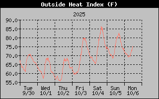
Heat Index: 72.4°F
High Heat Index: 73°F @ 12:00am
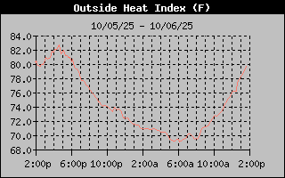
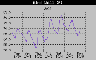
Wind Chill: 65.7°F
Low Wind Chill: 63°F @ 5:53am

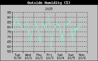
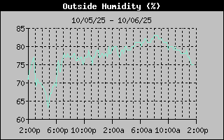
Humidity: 81%
High Humidity: 83% @ 7:50am
Low Humidity: 75% @ 1:17am
High Monthly Humidity: 92%
Low Monthly Humidity: 56%
High Yearly Humidity: 98%
Low Yearly Humidity: 37%

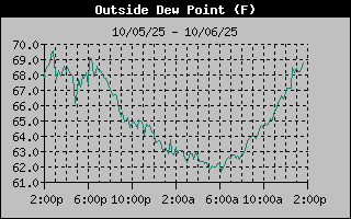
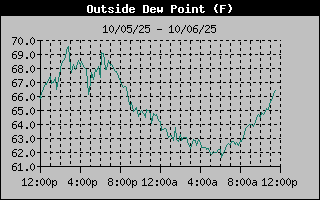
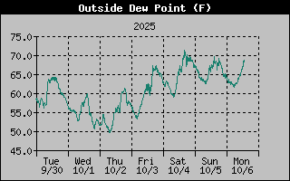
Dew Point: 64.8
High Dew Point: 65.0°F @ 12:00am
Low Dew Point: 62.0°F @ 1:16am
High Monthly Dew Point: 72.0°F
Low Monthly Dew Point: 50.0°F
High Yearly Dew Point: 82.0°F
Low Yearly Dew Point: -11.0°F

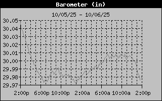
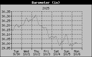
Barometer: 30.008
Barometer Trend:
High Barometer: 30.009 inHg @ 7:56am
Low Barometer: 29.971 inHg @ 1:01am
High Monthly Barometer: 30.313°F
Low Monthly Barometer: 28.962°F
High Yearly Barometer: 30.665°F
Low Yearly Barometer: 28.962°F


| Sunrise : | 7:37am |
| Sunset : | 7:05pm |
| Solar Noon: | 1:21pm |
| Moonset : | 6:53am |
| Moonrise : | 6:44pm |
| Full Moon |
 |
| 100% Illuminated |
11 hrs 27 min 38 sec of Sunlight Today.
Which is 2 min 59 sec shorter than yesterday.
Noon

Midnight

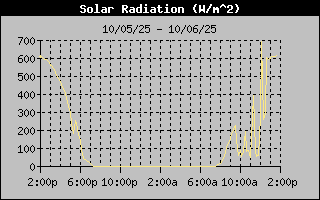
| 0.5 Low |
| High: 0.7 @ 9:49am |


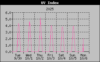
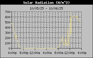
| 76 W/m2 |
| High: 244 @ 9:31am |


.jpg)