
Updated:
27-Oct-2025 10:05am


Overnight
Mostly Clear
Lo 34 °F
Monday
Sunny
Hi 52 °F
Monday
Night
Mostly Clear
Lo 37 °F
Tuesday
Sunny
Hi 55 °F
Tuesday
Night
Mostly Clear
Lo 39 °F
Wednesday
Mostly Sunny
Hi 53 °F
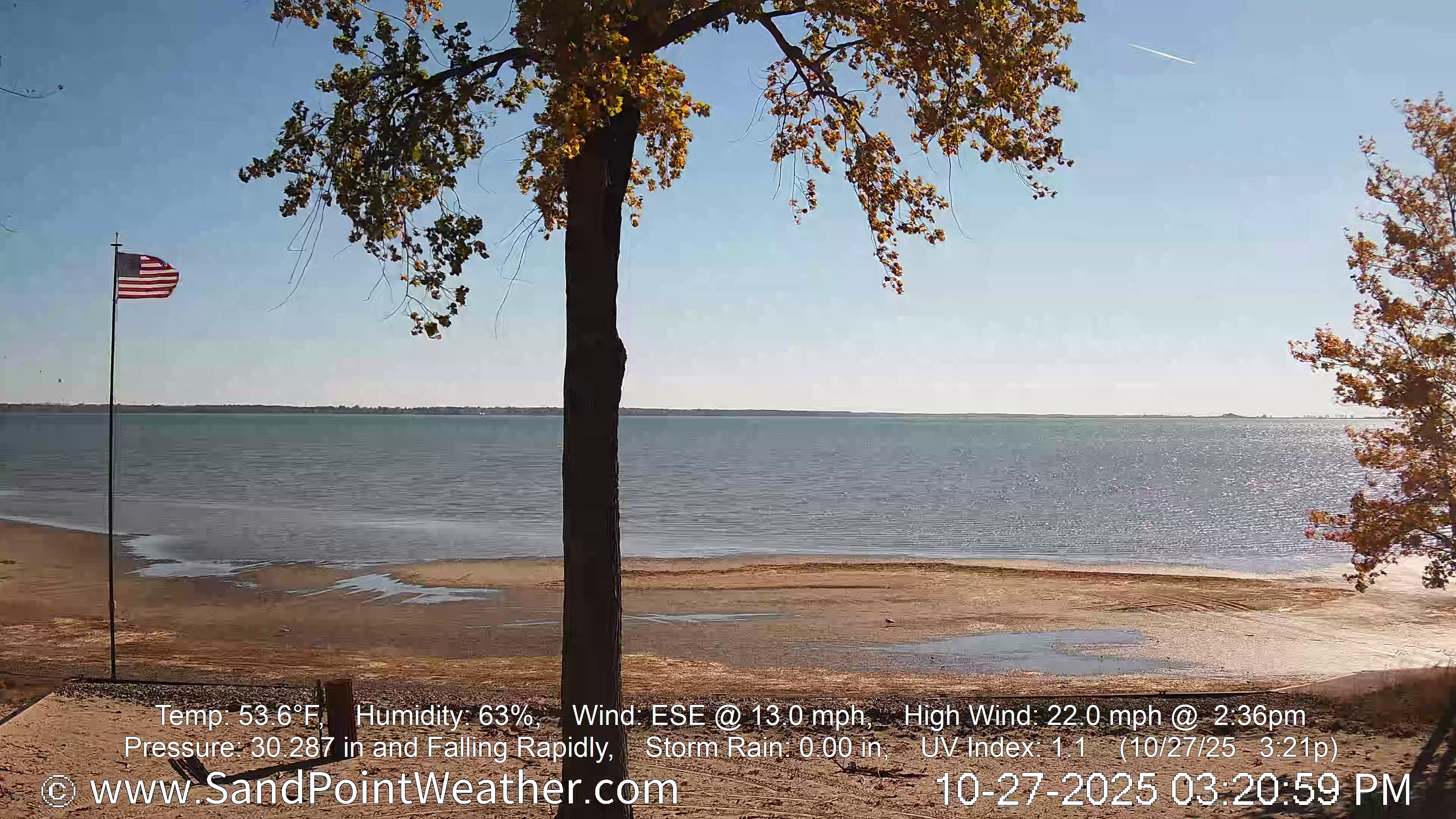
Sand Point Weather - Station DataUpdated: 27-Oct-2025 10:05am |
|
|
|
45.7°F Cold Feels like : 44°F |
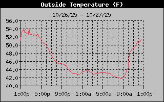
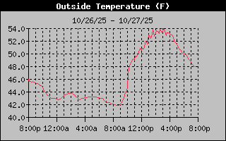
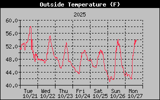
High Temerature: 45.8°F @ 10:06amm
Low Temperature: 41.7°F @ 8:31amm
High Yesterday Temp.: 54.1°F @ 2:40pm
Low Yesterday Temp.: 40.9°F @ 2:50am
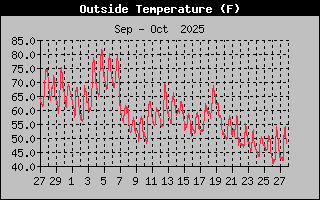
High Monthly Temp.: 81.8°F
Low Monthly Temp.: 40.9°F
High Yearly Temp.: 90.0°F
Low Yearly Temp.: -6.8°F
For this day (Oct. 27) the...
Average (Norm) High*: 55°F
Average (Norm) Low*: 37°F
Record High*: 76°F in 1927
Record Low*: 21°F in 1976
* Average & Record High/Lows are based on data from the Flint Bishop Airport, Flint, MI.


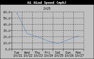
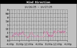
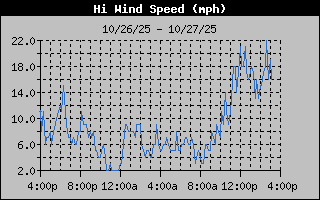
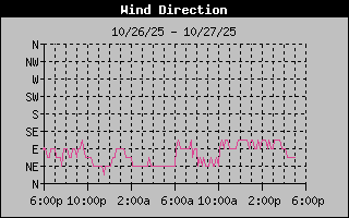
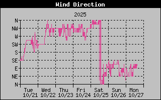
7 from the ESE
Gust to: 8 mph
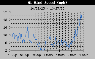
High Wind Speed: 9 mph @ 12:29am
High Monthly Wind Speed: 58.0 mph
High Yearly Wind Speed: 87.0 mph

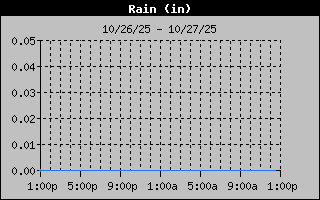
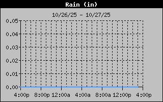
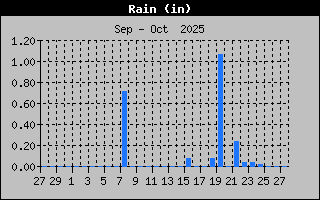
| Rain Today: | 0 in |
| Rain Yesterday: | 0 in |
| Storm Rain: | 0 in |
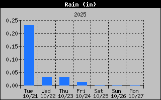
| Monthly Rain: | 2.21 in |
| Yearly Rain: | 14.93 in |


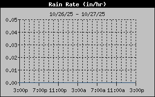
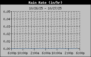
| Current Rain Rate: | 0 in/hr |
| High Rain Rate: | 0 in/hr @ ---- |
| High Hourly Rain Rate: | 0 in/hr |
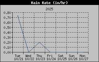
| High Monthly Rain Rate: | 1.16 in/hr |
| High Yearly Rain Rate: | 57.60 in/hr |

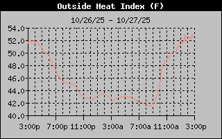
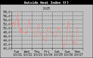
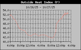
Heat Index: 45.4°F
High Heat Index: 46°F @ 10:06am
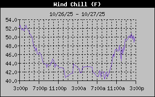
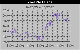
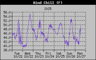
Wind Chill: 43.9°F
Low Wind Chill: 40°F @ 1:05am

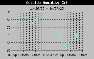
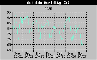
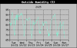
Humidity: 78%
High Humidity: 84% @ 12:02am
Low Humidity: 76% @ 1:51am
High Monthly Humidity: 97%
Low Monthly Humidity: 56%
High Yearly Humidity: 98%
Low Yearly Humidity: 37%
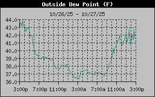
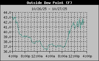
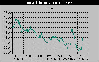
Dew Point: 39.2
High Dew Point: 39.0°F @ 9:34am
Low Dew Point: 36.0°F @ 2:23am
High Monthly Dew Point: 72.0°F
Low Monthly Dew Point: 36.0°F
High Yearly Dew Point: 82.0°F
Low Yearly Dew Point: -11.0°F

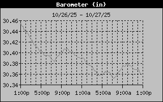
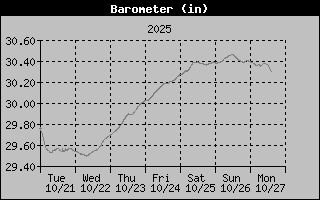
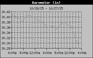
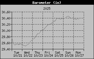
Barometer: 30.378
Barometer Trend:
High Barometer: 30.394 inHg @ 12:01am
Low Barometer: 30.351 inHg @ 7:15am
High Monthly Barometer: 30.508°F
Low Monthly Barometer: 28.962°F
High Yearly Barometer: 30.665°F
Low Yearly Barometer: 28.962°F
| Sunrise : | 8:03am |
| Sunset : | 6:30pm |
| Solar Noon: | 1:16pm |
| Moonrise : | 2:06pm |
| Moonset : | 10:25pm |
| Waxing Crescent |
 |
| 30% Illuminated |
10 hrs 26 min 53 sec of Sunlight Today.
Which is 2 min 46 sec shorter than yesterday.
Noon

Midnight

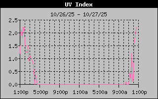
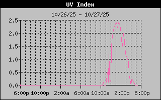
| 0.0 None |
| High: 0.5 @ 9:56am |


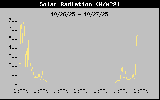
| 118 W/m2 |
| High: 255 @ 10:03am |


.jpg)